|
|
 |
|
 Underwater Global Positioning Systems (GPS) Underwater Global Positioning Systems (GPS)
|
|
|
Long Beach Dive offers two models of Underwater GPS systems that allow a diver the ability to utilize Global Positioning System (GPS) data while submerged on a dive.

|
|
|
|
RECON Pro
The RECON Pro is a complete underwater GPS system for use up to a depth of 70 feet (21 meters).

RECON Pro GPS Receiver
 read more read more

|
|
|
|
|
|
Accu-Dive Pro
The Accu-Dive Pro is also complete underwater GPS system , and has the option of adding a GPS signal amplifier allowing for additional depth capability up to 175 feet (53 meters).
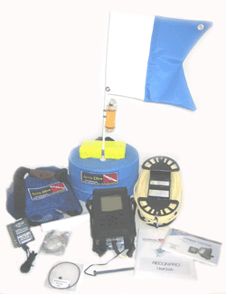
Accu-Dive Pro Components
 read more read more

|
|
|
 |
|
|
 |
 |
 Underwater Wireless Video Underwater Wireless Video
|
|
The SCUBA-Vis is a diver held video camera module that displays a live picture on a TV or LCD remotly located on the surface (up to 300 feet away), such as a dive boat or shoreline.
Personel on the surface can see the same images as the diver is seeing live.
Long Beach Dive's SCUBA-Vis system is available in both Recreational and Resort models.
|
|
SCUBA-Vis
The SCUBA-Vis is a single diver or snorkeler unit for use in depths up to 100 feet (30 meters).
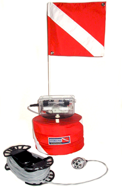
SCUBA-Vis Float/Camera
 read more read more
|
|
SCUBA-Vis RESORT
The SCUBA-Vis Resort is an underwater video system that allows a Hotel or Resort to offer their guests a way to video their underwater experiences, either SCUBA or Snorkeling, and then take those memories home on DVD.
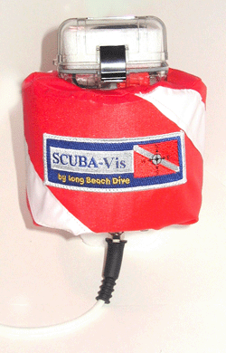
 read more read more

|
|
|
|
 |
 |
 Remotly Operated Underwater Vehicle (ROV) Remotly Operated Underwater Vehicle (ROV)
|
| Long Beach Dive will announce shortly* the availability of a new ROV product.
The ROV is an underwater exploration tool designed for both recreational and professional explorers.
ROV
*Please refer back to our website for further updates on the availibility and pricing of our new ROV product.
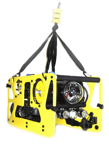
Remotly Operated Vehicle (ROV)
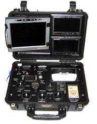
ROV Controls
 read more read more

|
|
 GPS Charts and Software GPS Charts and Software
Our RECON-Pro and Accu-Dive Pro Underwater GPS Systems can utilize off-the-shelf and custom charting software.
Garmin BlueChart Software
In addition to our base underwater GPS systems, customers may also purchase detailed charts* of the waterways where the underwater GPS system will be utalized. Gamin's MapSource BlueCharts are available for a wide range of worldwide locations.
 read more read more
|
|

